Method for finding accurate directions by a common analogue watch.
by tonytran2015 (Melbourne, Australia).
Click here for a full, up to date ORIGINAL ARTICLE and to help fighting the stealing of readers’ trafficby tonytran2015 (Melbourne, Australia).
#find North, #finding North, #compass, #direction, #by Sun, #bisector, #using watch, #with watch, #tilted watch, #inclined watch, #navigation, #without compass
This method uses a common 12-hour watch with analogue face for finding directions. Unlike the traditional method of using the hour hand of a flat lying watch, my method uses a watch tilted from the vertical and gives better accuracy for both North and South hemispheres including tropical zones. When applied to the arctic and antarctic regions, the watch is tilted by more than 67 degrees and lies almost flat on the ground; it becomes the traditional method using flat lying watch.
This method use the position of the Sun, time and known latitude angle to determine directions and Sun declination (therefore estimation of current month of the year).
The method for Northern latitudes is described below.
Method for Northern latitudes.
The word “bisector” here is used to mean the bisector of the angle between the midnight/midday marking and the hour hand.
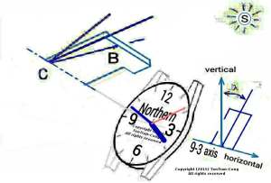
The red line is the bisector. The line CB is drawn on a card representing the half-plane to enable accurate alignment to the Sun
The bisector is in the opposite direction of a corresponding 24 hr hand on a 24 hr dial
1/- Hold the watch so that its AXIS rises above the horizontal plane by an angle equal to the latitude of the region. That is its face points to somewhere in the sky and its back is angled downwards into the ground.
2N/- Determine the half-plane limited by the axis of the watch and containing the bisector. This half plane revolves clockwise about the axis of the watch once every 24 hour and goes through the mid-day marking at noon.
3N/- Hold the watch in such composure and rotate your whole body around your vertical axis by your feet until the Sun lies in the above half-plane.
4N/- Alternative to step 3N, observer can determine on the semi-plane a half-line CB from the centre C of the watch dial, forming with the watch axis an angle equal to the angle between the direction to the Sun and the Celestial axis. The half-line CB starts from the center of the dial and is nearly in the direction of the bisector. It rises above the dial toward the glass and points through the glass of the watch during summer time and dives below the dial into the movement compartment of the watch and points through the movement of the watch during winter time. This half-line always points to the Sun if this watch displays the local time and the face of the watch and its axis point to the North Star. Instead of trying to have the half-plane containing the Sun, observer can try to have CB pointing to the Sun. This gives better accuracy.
5N/- At that position, the watch face and its AXIS are POINTING to the North Star. Tilt the watch further, until it lies horizontally. In this horizontal position, the mid-day marking is pointing South and the 6 o’clock marking is pointing North.
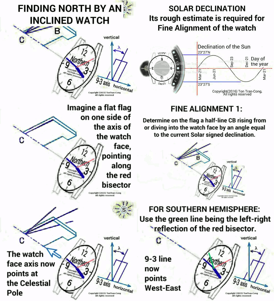
Figure: Summary of finding North by a watch. Red hand is the bisector of 0 hr direction and the hour hand; green hand is its reflection across the (6-12) axis. Axis C-BN for Northern hemisphere is parallel to red hand at equinox days and is (raised above)/(dipped below) the watch dial by 23 degrees at local summer/winter solstice. Axis C-BS for Southern hemisphere is parallel to green hand at equinox days and is (raised above)/(dipped below) the watch dial by 23 degrees at local summer/winter solstice. Green drawing marks are for Southern hemisphere and are the mirror reflection of red drawing marks.
Method for Southern latitudes.
The word “left-right flip of bisector” here is used to mean the the bisector the bisector of the angle between the midnight/midday marking and the hour after being flipped left-to-right, that is after being reflected across the line mid-day to 6 o’clock on the dial.
1/- Hold the watch so that its AXIS rises above the horizontal plane by an angle equal to the latitude of the region. That is its face points to somewhere in the sky and its back is angled downwards into the ground.
2S/- Determine the half-plane limited by the axis of the watch and containing the left-right flip of bisector . This half plane revolves anti-clockwise about the axis of the watch once every 24 hour and goes through the mid-day marking at noon.
3S/- Hold the watch in such composure and rotate your whole body around your vertical axis by your feet until the Sun lies in the above half-plane.
4S/- Alternative to step 3S, observer can determine on the semi-plane a half-line CB from the centre C of the watch dial, forming with the watch axis an angle equal to the angle between the direction to the Sun and the Celestial axis. The half-line CB starts from the center of the dial and is nearly in the direction of the bisector. It rises above the dial toward the glass and points through the glass of the watch during summer time and dives below the dial into the movement compartment of the watch and points through the movement of the watch during winter time. This half-line always points to the Sun if this watch displays the local time and the face of the watch and its axis point to the Southern Celestial pole. Instead of trying to have the half-plane containing the Sun, observer can try to have CB pointing to the Sun. This gives better accuracy.
5S/- At that position, the watch face and its AXIS are POINTING to the Southern Celestial pole. Tilt the watch further, until it lies horizontally. In this horizontal position, the mid-day marking is pointing North and the 6 o’clock marking is pointing South.
No ambiguity in equatorial latitudes.
The watch is placed almost vertically in equatorial latitudes by both methods. Methods for both Northern and Southern latitudes gives exactly the same outcomes.
Extension application for both hemispheres.
6/ This method applies equally well to the Moon when its declination as well as lateness relative to the Sun is known. If the Moon can be seen in day light, a navigator should continue from the so determined direction of the Celestial axis to take the declination of the Moon as well as its lateness (and its angular distance, which can be accurately measured using the divider) relative to the Sun for that day. He can then continue his accurate determination of Celestial axis during the Moon lit part of that night by replacing the unseen Sun by the Moon together with its value of declination and its lateness supplied by himself. (Remember that the Moon increases its lateness relative to the Sun by a further 50 minutes in every 24 hours).
Figure: Summary of finding North by a watch.
Actual field test.
The author has tested these methods and found them to be applicable, easy and accurate to much better than 30 degrees for latitudes from 0 to 40 degrees. The accuracy is better than 10 degrees when the Sun has low altitude.
Explanation notes.
N1/- The word “watch” here applies to any watch or clock.
N2/- When a watch or a clock dial is hung on a vertical wall, its midnight marking is at the highest position. If the hour hand of a watch completes one revolution in 24 hours the watch is called a 24-hour watch; if it completes in 12 hour the watch is called a 12-hour watch. Most watches and domestic clocks are 12-hour ones. The bisector of the midnight marking and the hour hand of any 12-hour watch complete one revolution in 24 hour. It moves like an imaginary 24-hour hand on that watch.
N3/-The axis of the watch is the oriented line (Note that it is more than “the oriented half-line”.) going through the center of the watch at right angle to its dial disc and is parallel to the rotation axes of both the minute pointer (or “minute hand”) and the hour pointer (or “hour hand”). The direction chosen on the line is from the back to the front face of the watch.
N4/- A watch display local time when it shows 12 o’clock when the Sun reaches its highest point in the sky.
N5/- The angle between the North Star and the Sun varies like a sine wave with amplitude of 23.5 degrees; it should be 90 degree during Spring and Autumn equinoxes and 90-23.5 degree at Northern Summer solstice (21st June) and 90+23.5 degree at Northern Winter solstice (21st of December).
N6/- To tilt the watch accurately as required by step1, we can carry out the following steps:
1a/- Note that hour markings on 12hr watch dials are separated by 30 degrees. Other angles can be similarly worked out.
1b/- Hold the watch verticaly with 0hr at highest position.
1c/- Rotate the watch (either left or right, it does not matter) by angle lamda, keeping its dial plane unchanged. The line 0hr-6hr now makes an angle lamda with the vertical line.
1d/- Keep the axis 0hr-6hr fix in space, rotate the watch around it until the dial is pointing upwards evenly. The watch dial is now tilted upward by the angle lamda.
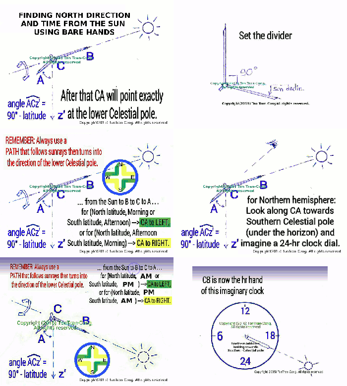
Relevant to this topic is also a method of finding North and time using neither watch nor compass [1].
Reference
[1]. tonytran2015, Finding North direction and time using the Sun and a divider, https://survivaltricks.wordpress.com/2015/05/06/finding-directions-and-time-using-the-sun-and-a-dividing-compass/
posted on May 06th, 2015.
RELATED SURVIVAL BLOGS (Added in December 2016)
Caution in finding North by bisector line of a horizontal watch. Posted on October 28, 2015
, posted on 2018 July 10
Finding directions and time using the Sun and a divider., posted on May 6, 2015. <<<—This is my MOST USEFUL novel technique.

Finding North direction and time using the hidden Sun via the Moon . Posted on July 6, 2015
Finding North direction and time accurately from the horn line of the Moon. Posted on August 12, 2015. This is my novel technique.
Finding North direction and time using the Moon surface features. Posted on July 1, 2015.
Finding-north-by-stars-for-beginners, posted on September 20, 2017
Finding North and time by stars. Posted on August 28, 2015
Finding North and time with unclear sky. Posted on October 17, 2015.
Finding North direction and time by any bright star, posted July 22, 2016
Click here for my other blogs on  SURVIVAL
SURVIVAL CONTENTS BLOG IMAGE OF SURVIVAL CONTENTS
![]()
MONEY CONTENTS BLOG IMAGE OF MONEY CONTENTS
SOCIAL ISSUES CONTENTS BLOG IMAGE OF CONT. OF SOCIAL ISSUES
LIVING BLOG LIVING CONTENTS BLOG IMAGE OF LIVING CONTENTS
HOW TO BLOG HOW TO CONTENTS BLOG IMAGE OF HOW TO CONTENTS
Click here go to  Home Page (Navigation-Survival-How To-Money).
ARCHIVAL HOME PAGE CONTENTS HOME PAGE BLOG IMAGE OF CONTENTS HOME PAGE






Thanks a lot for the article post. Really Great.
LikeLiked by 2 people
Like!! Great article post.Really thank you! Really Cool.
LikeLike
There is noticeably a bundle to know about this. I see you have made certain great points in your post as well.
LikeLiked by 1 person
Does your site have a contact page? I’m having a tough time locating it but, I’d like to shoot you an e-mail. I’ve got some recommendations for your blog you might be interested in hearing. Either way, great website and I look forward to seeing it grow over time.|
LikeLike
I’ve read a few excellent stuff here. Definitely value bookmarking for revisiting. I surprise how much attempt you set to make any such wonderful informative website.|
LikeLike
Saved as a favorite, I like your web site!|
LikeLike
Hey very interesting blog!|
LikeLike
Great post. I was checking constantly this blog and I’m inspired! Very helpful information particularly the closing section 🙂 I care for such information a lot. I was seeking this particular info for a long time. Thank you and best of luck. |
LikeLike
Helpful information. Lucky me I discovered your website accidentally, and I’m shocked why this coincidence didn’t took place in advance! I bookmarked it.|
LikeLike
It’s hard to come by well-informed people about this subject, but you seem like you know what you’re talking about! Thanks|
LikeLike
With havin so much written content do you ever run into any problems of plagorism or copyright violation? My site has a lot of unique content I’ve either authored myself or outsourced but it looks like a lot of it is popping it up all over the internet without my permission. Do you know any solutions to help reduce content from being stolen? I’d genuinely appreciate it.|
LikeLike
Really no matter if someone doesn’t be aware of afterward its up to other viewers that they will assist, so here it happens.|
LikeLike
I absolutely love your site.. Pleasant colors & theme. Did you build this site yourself? Please reply back as I’m planning to create my own site and want to know where you got this from or just what the theme is called. Kudos!|
LikeLike
Way cool! Some very valid points! I appreciate you writing this post and the rest of the website is also really good.|
LikeLike
[…] Source: Finding accurate directions using a watch […]
LikeLike
Thank you Rifleman III for liking and linking
LikeLike
I made a minor error when I described the Folded-Cardboard-Universal-Equatorial sun-compass:
I said that the solar-declination scale was marked on the squares’ north edges. But that’s only true when it’s used in the summer use-configuration.
What I should have said is:
The solar-declination scale is marked on the edges of the squares intended as the upper edge, starting from the fold in the cardboard.
Michael Ossipoff
LikeLike
Hi Michael,
Please attach or give a link to the Folded-Cardboard… It may turns out that some drawings of your own improved designs of the template can be useful to some people.
LikeLike
Good idea! It greatly improves on the accuracy of the Watch Method. It could probably be described a little more simply, though.
Good at any latitude. Its accuracy is limited only by how well you keep it tipped for your latitude.
More accurate than either of the two traditional methods (ordinary Watch Method, and Shadow-Tip method).
What you describe could also be regarded as the use of a tilted watch to improvise the Universal Equatorial Ring-Sundial (which can be used as a sun-compass)
A navigation book once proposed, described and printed a folded-cardboard version of the Universal Equatorial Ring-Dial:
A 2:1 ratio rectangle, on paper, is divided into 2 squares.
On each square, make 90 degree graduated quarter-circle arcs, centered on corners of the squares.
Fold into a right angle, along the boundary between the squares, so that the 2 squares are at right angles to eachother.
Optionally, a piece of thread or string can hold the folded cardboard at a right angle.
One square will be held in the equatorial plane, and the other square’s edge will be the gnomon that casts its shadow onto the equatorial square’s graduated quadrant circle.
The gnomon edge should be parallel to the Earth’s axis. ..by means of a pendulum consisting of a penny taped to a short piece of thread or string. …or just by means of one of the graduated quadrant-circles and a guess at where the horizon is. (because the horizon isn’t usually visible in the hills).
This has been just a rough description, not a complete instruction.
Rotate it about its vertical axis till it tells the right time, on the graduated quadrant-circle of the equatorial square. When it tells the right time, then the gnomon-edge is pointed north.
Like the usual Universal Equatorial Ring-Dial, this folded cardboard one can also have a provision for measuring solar declination. Then, without knowing the time, the device can be rotated till it registers the correct solar declination, at which point the gnomon-edge is pointing north.
That declination-measuring provision consists of a declination-scale marked on each of the squares’ north edges, starting at the fold-line. An improvised sliding-tab is positioned on that scale at the appropriate declination-mark, and the device is rotated about its vertical axis till the tab’s shadow just reaches the arc line of the quadrant-circle on the equatorial square.
Not a very clear description, but it’s only intended as a hint, to tell the principle of this easily-made device.
Depending on whether the season is on the summer or winter side of the equinoxes, one square or the other will serve as the equatorial square. …because, dependin on the season, you’ll be observing the shadow on the top or bottom surface of the equatorial square.
But your tilted-watch method can serve the same purpose without building anything, and its accuracy is only limited by how well you orient the watch for latitude.
Michael Ossipoff
LikeLiked by 1 person
Thank you, Michael, for your comment and your detailed description of the “card board” method.
Yes, my tilted watch method relies on the user knowing his vertical and horizontal and the tilt angle. Since the watch face can also serve as a protractor with each 1hr/12hr graduation represent a step of 30 degrees in angle, I suppose that most users can keep the tilt within 10 degrees of his latitude angle.
For those who needs direct and easy tilt angle read-outs, I would recommend pressing the straight edge of a simi-circular protractor onto the back of the watch while having a thread serving as a vertical line by going through the center of the protractor arcs to a plumb bob slightly underneath the arcs. The amount of tilt would then be known to within one graduation mark (usually being 1 degree).
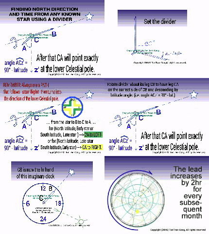
You may also be interested in my method to find out direction and time using only a compass divider.
Regards,
LikeLike
Yes, direction-finding methods interest me, so I’d be interested in hearing about the use of a compass-divider for that purpose, or for time-determination.
That navigation book that I referred to contained a printed copy of the folded-cardboard sun-compass/sundial, with the suggestion to xerox it, cut it out, and paste it onto cardboard.
I did so, and I have a folded cardboard sun-compass/sundial.
But the easiest-to-use, most convenient and versatile, sun-compass is the Universal Analemmatic Sun-Compass. It’s just printed on a flat piece of paper (which may or may not be pasted onto cardboard).
Other than the drafting or printing-out of it, no other construction or building is needed.
It was first introduced in the 16th or 17th century.
An ordinary (not universal) Analemmatic sun-compass is the printed flat dial-face of an Analemmatic sundial.
A Universal Analemmataic sun compass is an Analemmatic sun-compass with a latitude-ellipse for every latitude.
in addition to requiring nothing more than a printed piece of paper, that device has the advantage of being usable even when the sun isn’t shining on it. Maybe you’re in a car, and the shadows of the telephone-poles are visible from your car window. The Analemmatic sun-compass will tell you the angle between north and the direction of shadows (for any date and time–and latitude if it’s universal).
So, if shadows of telephone poles are visible from your car window you know where north is, with respect to the direction that the shadows are pointing.
Michael Ossipoff
LikeLiked by 1 person
Hi Michael, the method is describe in
“Finding accurate North-South directions and local time using the Sun and a divider” of this blogspot. I also have it explained in details in “Instructables”. The keys words to search for it are “Find, North, Direction, Bare hands”.
Cheers
LikeLike
Reblogged this on Brittius.
LikeLike
Thank you, Brittius,
Regards,
LikeLike
You’re welcome.
LikeLike